May Lunch & Learn: Modernize Your ArcGIS Web AppBuilder Apps Using Experience Builder
Join your IGIC colleagues for the May 2023 Lunch & Learn on Wednesday, May 17, 2023, at noon. ArcGIS Experience Builder is built on the latest web technologies. As more capabilities are added to Experience Builder, it might be time to consider modernizing your ArcGIS Web AppBuilder apps. In this session, you will learn how…
ITAG Conference
West Des Moines Sheraton 1800 50th Street, West Des Moines, IA, United StatesView ITAG 2023 Conference Information 2023 ITAG Conference Tuesday, June 13, 2023 – Friday, June 16, 2023 West Des Moines Sheraton 1800 50th Street, West Des Moines, Iowa 50266 The ITAG Conference is a joint effort between the Iowa Geographic Information Council (IGIC) and the Iowa Counties Information Technology (ICIT) organizations to combine annual conferences into one comprehensive…
IGIC Summer 2023 Business Meeting
The Summer 2023 Quarterly Meeting will be held on Wednesday, July 19, 2023, starting at 10:00 am. This will be a virtual meeting. IGIC July 2023 Meeting Agenda Call-In Meeting Option through WebEx https://iastate.webex.com/iastate/j.php?MTID=m02b539f6a2a028088e0c36c4aa5c5fa8
August 2023 Lunch & Learn: NG9-1-1 in Iowa GIS Updates
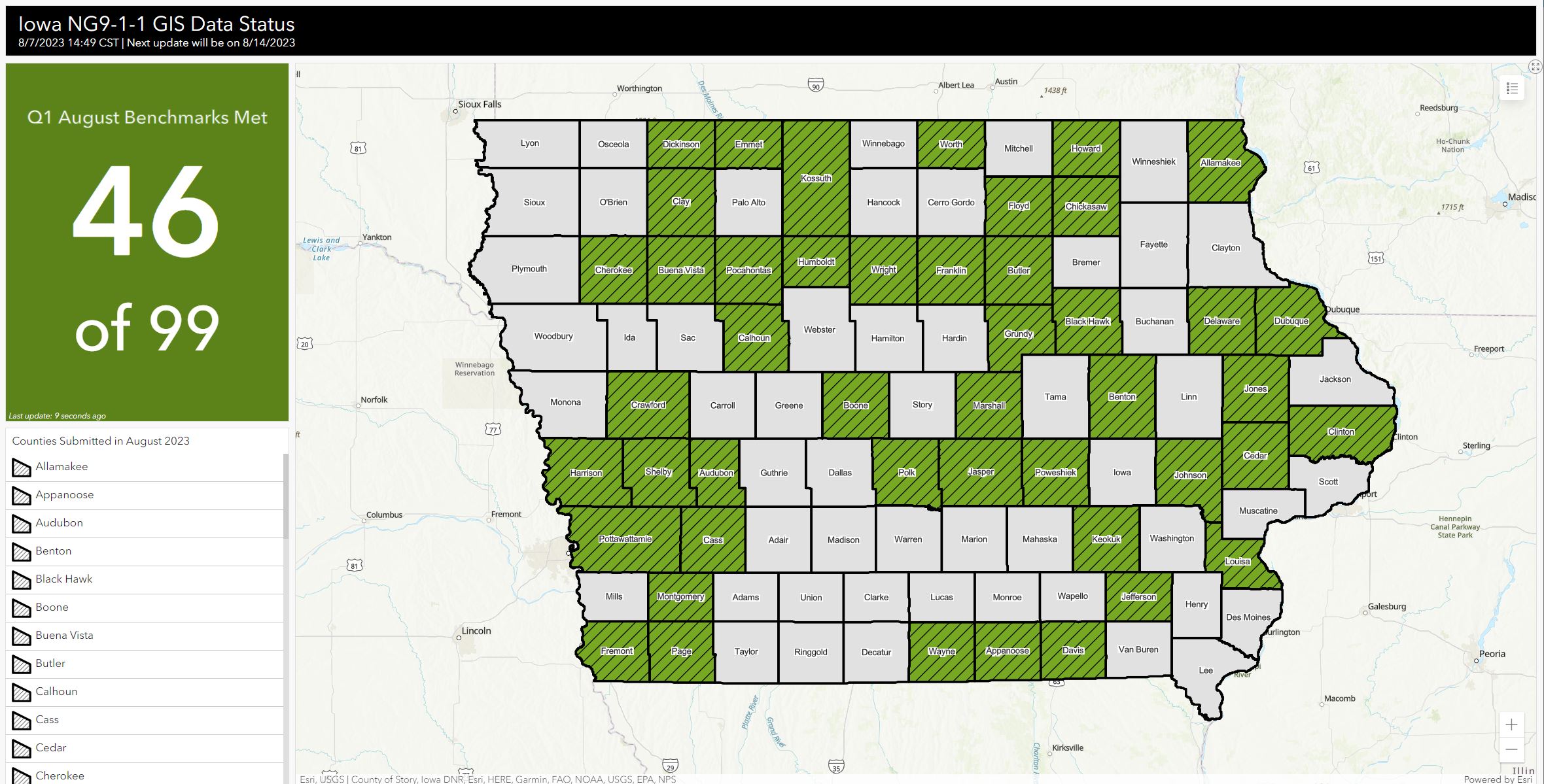
Join your fellow IGIC members for the August 2023 Lunch & Learn on Wednesday, August 16, 2023, at noon. GeoComm provides the State of Iowa 911 with an online map-based dashboard of the NG9-1-1 GIS project. The map-based dashboard is updated each Monday and the first day of the month to show the status of…
September 2023 Lunch & Learn
September 2023 Lunch & Learn: Accessing Iowa Map Services in GIS and Web Applications The September 2023 Lunch & Learn will be on Wednesday, September 20, 2023, at noon. Explore Iowa map and image services provided by Iowa State University, USDA-NRCS, Iowa DNR, and other agencies and organizations. The services include historical and current imagery,…
IGIC Fall 2023 Business Meeting
The Fall 2023 Quarterly Meeting will be held on Wednesday, October 18, 2023, starting at 10:00 am. This will be a virtual meeting. Call-In Meeting Option through WebEx https://iastate.webex.com/iastate/j.php?MTID=m40264e85fe12e3952dedd92250542dcf
IGIC Winter 2024 Business Meeting
The Winter 2024 Quarterly Meeting will be held on Wednesday, January 17, 2024, starting at 10:00 am. This will be a virtual meeting. Details to come.
IGIC Spring 2024 Business Meeting
The Spring 2024 Quarterly Meeting will be held on Wednesday, April 10, 2024, at 10:00 am. Call -In Meeting Option through WebEx Join from the meeting link https://iastate.webex.com/iastate/j.php?MTID=mb9825cae53875faf30d2bbd84c195d62 Join by meeting number Meeting number (access code): 2634 410 3012 Meeting password: 37HAtQvG3DT
IGIC Summer 2024 Business Meeting
The Summer 2024 Quarterly Meeting will be held on Wednesday, July 10, 2024, at 10:00 am. Call -In Meeting Option through WebEx Join from the meeting link https://iastate.webex.com/iastate/j.php?MTID=m780076e9c2b789cd8c2b33da20be061a Join by meeting number Meeting number (access code): 2632 994 8146 Meeting password: HYexvCiR649
IGIC Fall 2024 Business Meeting
The Falls 2024 Quarterly Meeting will be held on Wednesday, October 16, 2024, at 10:00 am. Call -In Meeting Option through WebEx Join from the meeting link https://iastate.webex.com/iastate/j.php?MTID=mdc5d740970e2ec2a4332df12d5d17b6b Join by meeting number Meeting number (access code): 2632 117 5062 Meeting password: gqWEMpaF235
